
What people are doing with gprMax
gprMax is a free, open-source research platform for time-domain computational electromagnetics. It solves Maxwell’s equations with the finite-difference time-domain (FDTD) method, for ground-penetrating radar, antennas and microwaves, scattering, bioelectromagnetics, and radiometry (about the software). The peer-reviewed studies below span planetary radar, glaciology, antennas, civil infrastructure, and biomedical imaging — a selection from more than 1,600 publications citing gprMax.
 Planning a radar sounder for Mars
gprMax simulated Perseverance’s radar over Jezero Crater geology before launch.
Planning a radar sounder for Mars
gprMax simulated Perseverance’s radar over Jezero Crater geology before launch.
Planning a radar sounder for Mars, before it launched
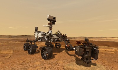
RIMFAX — the Radar Imager for Mars’ Subsurface Experiment — is the ground-penetrating radar carried by NASA’s Perseverance rover. Unlike a terrestrial survey, there was no opportunity to trial the instrument over the target ground first: the team had one landing site, one instrument, and a need to know in advance what the returns would look like.
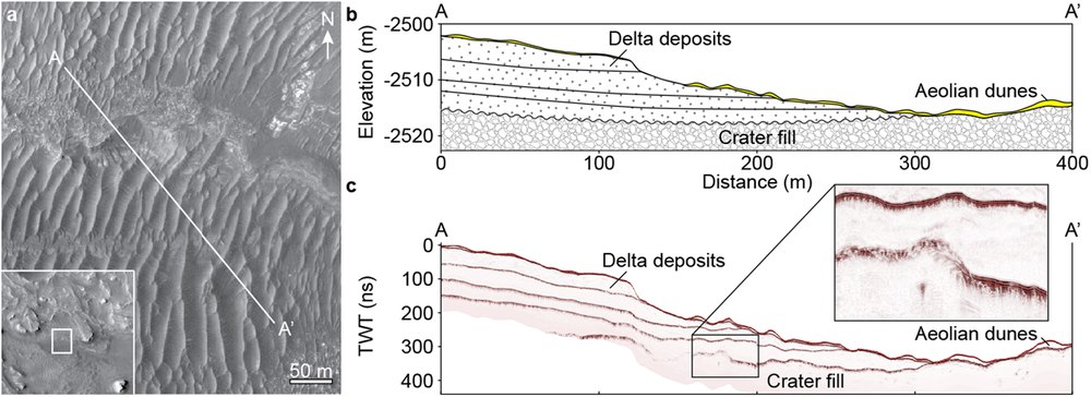
So they built the ground instead. Geological interpretations from orbital imagery were turned into subsurface models, and gprMax was used to simulate radar propagation through them in three dimensions. Applying that framework to a sample of Jezero Crater geology, the team constructed and modelled a 400 metre transect — establishing what RIMFAX should be able to resolve, and how to read the returns once they started arriving.
The paper notes that some of gprMax’s more advanced capabilities were used to make the models realistic, including fractal-based surface roughness rather than idealised flat interfaces.
Hamran, S.-E. et al. (2020). Radar Imager for Mars’ Subsurface Experiment — RIMFAX. Space Science Reviews 216, 128. 10.1007/s11214-020-00740-4. Thumbnail: NASA/JPL-Caltech.
 Sounding 300m into the far side of the Moon
A forward-modelled stratigraphy validated the first radargram from the lunar farside.
Sounding 300m into the far side of the Moon
A forward-modelled stratigraphy validated the first radargram from the lunar farside.
Sounding 300m into the far side of the Moon
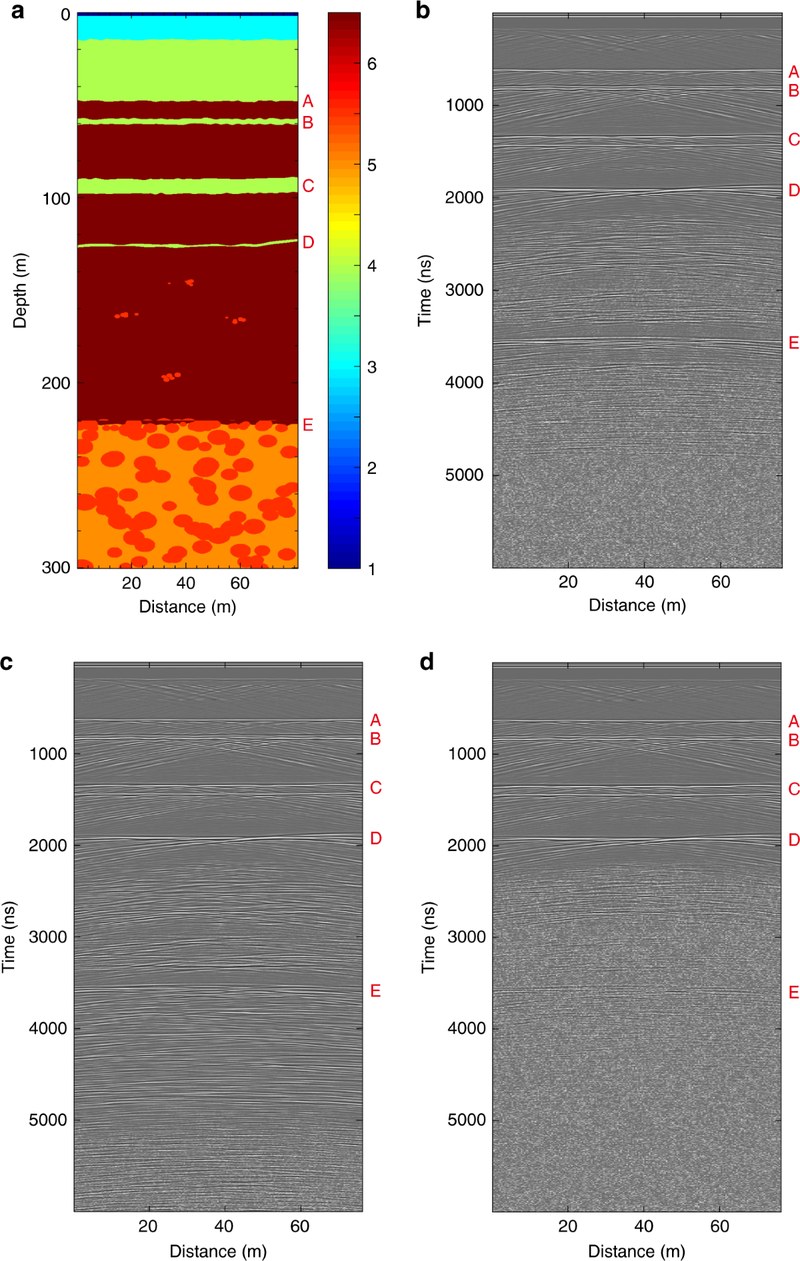
China’s Chang’e-4 mission put the Yutu-2 rover down inside Von Kármán crater, on the floor of the South Pole-Aitken basin — the first landing on the lunar farside. Over its first nine months the rover’s Lunar Penetrating Radar returned a profile of the subsurface beneath its traverse, revealing buried ejecta overlaid by at least four distinct lava flows, with thicknesses ranging from 12 m to around 100 m.
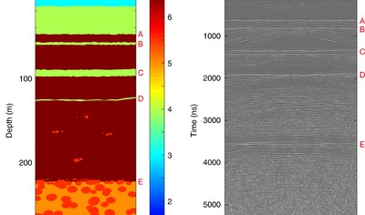
The difficulty with a radargram from somewhere nobody has ever been is that there is nothing to check the interpretation against. The team addressed this by working forwards: they built their proposed stratigraphic model as a gprMax simulation in 2D transverse-electric mode, added Gaussian noise matched to the instrument’s own noise floor, and compared the synthetic radargram with the one the rover actually produced.
Agreement between the two is what turns a plausible reading of the data into a supported one. It is the same logic as the B-scan example in our documentation, applied 380,000 km away.
Li, C. et al. (2020). First look by the Yutu-2 rover at the deep subsurface structure at the lunar farside. Nature Communications 11, 3426. 10.1038/s41467-020-17262-w
 Benchmark GPR datasets from a realistic 3D model
Open benchmark datasets for testing GPR processing and inversion algorithms.
Benchmark GPR datasets from a realistic 3D model
Open benchmark datasets for testing GPR processing and inversion algorithms.
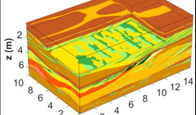
Benchmark GPR datasets from a realistic 3D sedimentary model
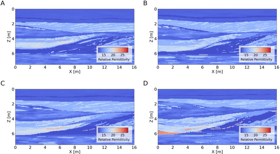
Developing a new processing or inversion algorithm needs data where the right answer is known — which field data never provides. This group builds that ground truth in simulation, and publishes it for the whole community.
The first release established a realistic, multi-scale heterogeneous 3D subsurface model from outcrop observations, then used gprMax’s GPU engine to produce 3D GPR data volumes at 50, 100, and 200 MHz densely sampling the entire model area. The follow-up extends the approach to a 2D multi-offset, multi-frequency benchmark replicating realistic subsurface conditions across four sections, with carefully defined acquisition geometries.
Both datasets are publicly available on Mendeley Data with documented Python and MATLAB scripts, in HDF5, VTK, and SEG-Y formats — a robust framework for evaluating and improving GPR processing and interpretation techniques.
Koyan, P. & Tronicke, J. (2020). 3D modeling of ground-penetrating radar data across a realistic sedimentary model. Computers & Geosciences 137, 104422. 10.1016/j.cageo.2020.104422 Banner and figure: Roncoroni, G. et al. (2025). Scientific Data 12, 221, CC BY 4.0.
 Measuring tree roots without digging them up
Synthetic responses trained a neural network to turn reflections into root diameters.
Measuring tree roots without digging them up
Synthetic responses trained a neural network to turn reflections into root diameters.
Measuring tree roots without digging them up
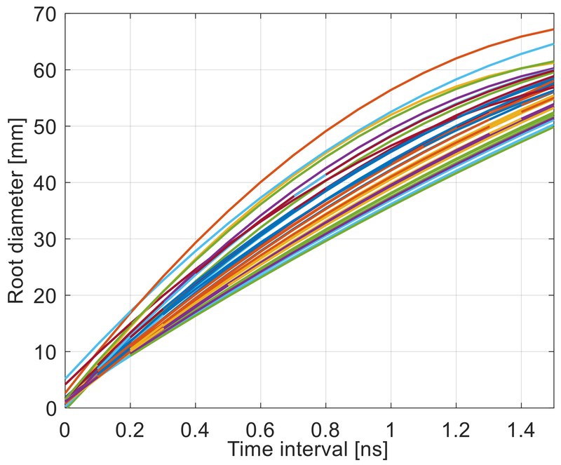
Root systems are among the hardest things in ecology to measure. The traditional method is excavation, which is laborious, and destroys the thing being studied along with the soil environment around it. GPR offers a non-destructive alternative, but converting a reflection into a root diameter is not straightforward: the returned signal depends on the root’s water content and the surrounding soil as much as on its size.
This study built the calibration in simulation. Root responses were forward-modelled in gprMax across a range of soil dielectric constants and root diameters at 1.5 GHz, and the resulting synthetic responses used to train a neural network to invert the relationship.
The paper is unusual in naming the software in its title — Theoretical Development of Plant Root Diameter Estimation Based on GprMax Data and Neural Network Modelling — which is a fair reflection of how much of the work the simulation is doing. Vegetation is one of the larger constituencies in our publications list, with 58 papers and over 900 onward citations.
Liang, H. et al. (2021). Theoretical development of plant root diameter estimation based on GprMax data and neural network modelling. Forests 12(5), 615. 10.3390/f12050615
 Open-source antenna design, benchmarked
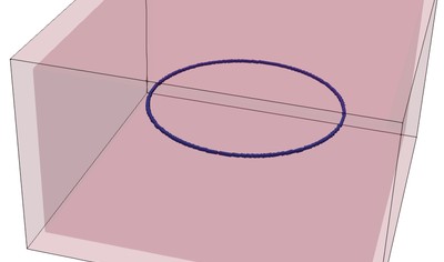
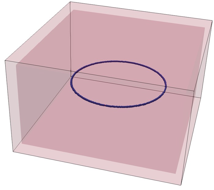
gprMax matched commercial solvers across loop, box-plate and patch antenna benchmarks.
Open-source antenna design, benchmarked
gprMax matched commercial solvers across loop, box-plate and patch antenna benchmarks.
Open-source antenna design, benchmarked by an antenna maker
Commercial electromagnetic solvers carry licence fees that put them out of reach of many small companies and research groups. This study — a collaboration between the University of Genoa and the antenna manufacturer Atel Antennas — asked whether open-source packages are ready to carry professional antenna design work.
Three open-source solvers, gprMax among them, were benchmarked against commercial and academic method-of-moments codes on canonical structures: a circular loop, a box-plate antenna, and a rectangular patch. The verdict on the hardest case: “a very good agreement between the various electromagnetic solvers is observed, despite the complexity of the structure.”
The paper’s assessment of gprMax is one we are happy to frame: born for GPR but “nowadays properly considered a general-purpose simulator”, with GPU acceleration singled out, and “great attention paid to the theoretical correctness of the employed algorithms.”
Fedeli, A., Montecucco, C. and Gragnani, G.L. (2019). Open-source software for electromagnetic scattering simulation: the case of antenna design. Electronics 8(12), 1506. 10.3390/electronics8121506
 Tracking a glacier’s internal drainage
Synthetic radargrams calibrated thickness recovery for a glacier’s internal drainage.
Tracking a glacier’s internal drainage
Synthetic radargrams calibrated thickness recovery for a glacier’s internal drainage.
Tracking a glacier’s internal drainage through the melt season
Meltwater on a glacier surface does not stay there. It finds its way down through the ice to the bed, and how much arrives and when has a direct effect on how fast the glacier moves. The conduits that carry it are hard to observe: they are inside the ice, they change through the season, and digging is not an option.
Between 2012 and 2019 a team ran repeated 25 MHz GPR surveys over an active englacial conduit network in the ablation area of the Rhonegletscher in Switzerland — annually at first, then more frequently through 2018 and 2019 to catch seasonal variation.
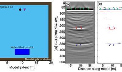
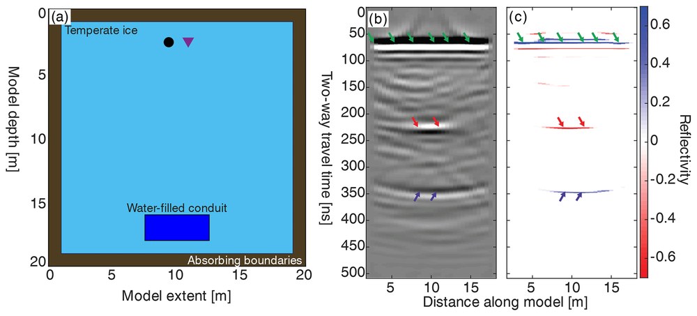
The difficulty is that a radar reflection tells you a conduit is there, not how wide it is. A water-filled void thinner than the vertical resolution still reflects, so thickness has to be recovered from the amplitude, and that inversion needs calibrating against something with a known answer. The team built that reference in gprMax: a model containing a single water-filled conduit of known thickness in temperate ice, with absorbing boundaries on all sides, then pushed the synthetic radargram through the identical processing workflow they had applied to the field data. Comparing recovered thickness against true thickness is what makes the field numbers defensible.
Church, G., Grab, M., Schmelzbach, C., Bauder, A. and Maurer, H. (2020). Monitoring the seasonal changes of an englacial conduit network using repeated ground-penetrating radar measurements. The Cryosphere 14, 3269–3286. 10.5194/tc-14-3269-2020
 Detecting strokes with microwaves
gprMax simulated a full voxel head model to test a portable stroke-imaging method.
Detecting strokes with microwaves
gprMax simulated a full voxel head model to test a portable stroke-imaging method.
Detecting strokes with microwaves
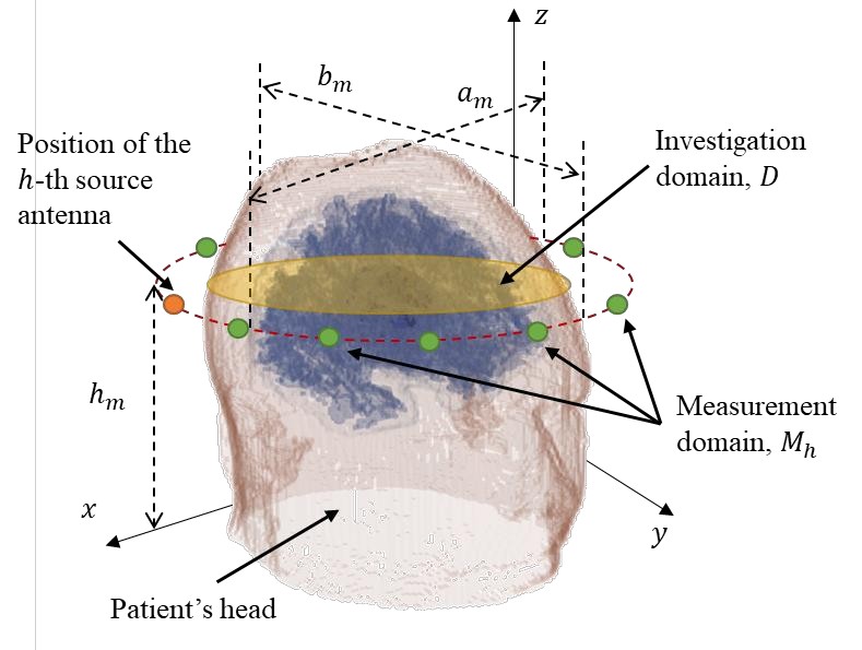
When a stroke is suspected, the first question is whether it is ischemic or haemorrhagic — the treatments are opposite, and the clock is running. Microwave imaging offers a portable, low-power alternative to CT for that triage: each antenna radiates milliwatts, less than a mobile phone.
Testing an imaging algorithm needs head data where the answer is known, so the team generated it in simulation: gprMax solved the full three-dimensional forward problem over the AustinWoman voxel head model — the same anatomical phantom that ships as a gprMax toolbox — with tissue properties described by multi-pole Debye models, and synthetic strokes introduced at known positions.
Against that ground truth, their multifrequency inversion method reconstructed the dielectric contrast of the stroke region, before being tested on laboratory measurements of simplified head models.
Fedeli, A., Schenone, V., Estatico, C. and Randazzo, A. (2025). Stroke detection and monitoring by means of a multifrequency microwave inversion approach. Electronics 14(3), 543. 10.3390/electronics14030543
 Finding voids hidden behind tunnel rebar
gprMax scenes helped train and validate a network that strips rebar clutter from GPR images.
Finding voids hidden behind tunnel rebar
gprMax scenes helped train and validate a network that strips rebar clutter from GPR images.
Finding voids hidden behind tunnel rebar
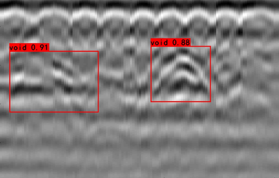
Voids behind a tunnel lining are exactly what a maintenance survey needs to find — and exactly what the lining’s own reinforcement hides. A row of rebar a few centimetres below the surface fills a GPR image with bright hyperbolas that mask the subtler reflections from defects behind them.
RCE-GAN is a generative adversarial network trained to remove that clutter, with an attention module and dilation centre to preserve the void signatures underneath. To prove the idea works, the team built series of numerical tunnel-lining models in gprMax — air, lining, rebar rows 5–10 cm deep, and voids of different sizes — where the true defect is known, before applying the network to laboratory and field data.
With the rebar clutter stripped, downstream void-detection networks found defects they had previously missed.
Wang, Y., Qin, H., Tang, Y., Zhang, D., Yang, D., Qu, C. and Geng, T. (2022). RCE-GAN: a rebar clutter elimination network to improve tunnel lining void detection from GPR images. Remote Sensing 14(2), 251. 10.3390/rs14020251
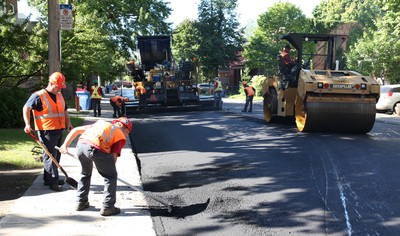 Monitoring asphalt compaction in real time
Calibrated gprMax models turn GPR returns into pavement density during rolling.
Monitoring asphalt compaction in real time
Calibrated gprMax models turn GPR returns into pavement density during rolling.
Monitoring asphalt compaction in real time
How long a road lasts is set largely in the hours it is built: under-compacted asphalt fails early, and the traditional checks — coring the fresh mat, or nuclear density gauges — are destructive, slow, or heavily regulated.
This work builds the case that GPR can monitor compaction continuously while the roller works. The centre of the argument is simulation: a gprMax model of the antenna over a two-layer pavement, calibrated until the simulated signal reproduces the measured one, so that the relationship between the radar return and the mixture’s density can be established with the ground truth known.
The acknowledgments thank gprMax’s original author for providing the code — a nice trace of open software finding its way into highway engineering.
Shangguan, P. and Al-Qadi, I.L. (2015). Calibration of FDTD simulation of GPR signal for asphalt pavement compaction monitoring. IEEE Transactions on Geoscience and Remote Sensing 53(3), 1538–1548. 10.1109/TGRS.2014.2344858. Thumbnail: Marc-Lautenbacher via Wikimedia Commons, CC BY-SA 4.0.










Developed by researchers in the School of Engineering at The University of Edinburgh, in the School of Engineering, Physics, and Mathematics at Northumbria University, and in the State Key Laboratory of Lunar and Planetary Sciences at Macau University of Science and Technology. Supported by Google through six years of Google Summer of Code (2019, 2021, and 2023–2026), whose students have contributed major features and toolboxes; and sponsored by Zulip.
Copyright © 2015-2026, Craig Warren & Antonis Giannopoulos